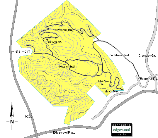
Pulgas Ridge Open Space Preserve
Situated on the I-280 Corridor west of San Carlos
This was an interesting acquisition for the MROSD.
Paid for in part by local residents via an Assessment District, this site, situated in the hills west of San Carlos(generally acknowledged to be a "Senior" community), could be accessible from a "vista" stop on I-280 and adjoins the "Lands of Benedetti".
These lands, with an I-280 access, present an ideal setting for a privately developed, "Senior Citizen Community" on the "Lands of Benedetti", in conjunction with the creation of Serpentine Summit Golf Course(name proposed by Dave Collins) and other retirement activities on Pulgas Ridge, open to the public. (see Crystal Springs Golf Course as an example) These land uses would preserve the "open space" nature of the property. It would also minimize senior citizen travel on our highways! Check the location of other "reasonable" public golfing facilities in the area!
Reclaimed water would be used for Lake and Stream augmentation, as well as providing essential irrigation for Brittan Heights residents. Lower Cordilleras Creek on the Preserve could provide the means for creating a lake(Geracie Lake)along the Polly Geracie Trail. A much needed firebreak would result.
Monies acruing from golf course revenues would first be used to return assessments to local residents, and then used to offset the cost of trail maintenance.
Homes vacated by local seniors, moving to the Serpentine Summit Senior Community, would then be available for the younger generations supporting the Silicon Valley economy.
This is a view from the Vista looking through a "new" chain link fence. Credit for this "brilliant" barrier to public access goes to Kenneth Nitz, MROSD Ward 7.
Note: Yet another chain link fence adorned with barbed wire appears in the above photo along the Pulgas Ridge Preserve roadway.
What about access?
HOW TO GET THERE(MROSD directions from http://www.openspace.org/PULGAS.html)
From interstate 280, take the Edgewood Road exit. Travel 0.75 miles northeast on Edgewood Road toward San Carlos and Redwood City. Turn left (north) on Crestview Drive, and then immediately turn left on Edmonds Road. Limited roadside parking is available along Crestview Drive and Edmonds Road.
NOTE the convenience of the Vista Point to the Pulgas Ridge Site!
My advice is to avoid the extremely dangerous Edgewood-Crestview intersection. Edmonds Road is on the extreme right in the photo below. In the center of the photo is the roadway coming from I-280. Disaster is lurking at the intersection!
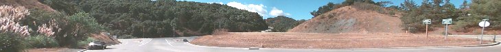
DANGEROUS - Edgewood - Crestview Intersection
Alternate possibilities would be to use the Park-n-Ride lot and hop the fence, or the Vista point, and hop two fences, or, if you're creative, you might find a way to avoid "hopping". Parking is much better at both alternates.
Those who prefer the "politically correct" solution can contact their elected representatives and lobby for "open access" to this "Open Space Preserve"! If you're young enough, you might see it happen. Or, Vote for Jack Hickey.
Campaign promise from Jack Hickey
As a member of the MROSD Board of Directors, and a taxpayer's advocate, I will strive to get an entrance into Pulgas Ridge from the Vista Point. And, I will promote a revenue producing golf course on the site.
What has MROSD done with this property?
Located along historic Pulgas Ridge, this preserve was once the site of the Hassler Health Home. The buildings were removed by the District in 1985. (where was the Historical Society on this one?). Those buildings could have served as the basis for a Golf Clubhouse and "revenue producing" environmental artifact and information center. Now, proposed removal of "non-indigenous" eucalyptous trees has stirred some controversy.
Here's an up-to-date photo of the MROSD maintained path leading to Geracie trail.(Taken on 30 Aug. 1998)
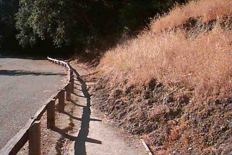
Notice that damage from "el nino" has yet to be repaired.
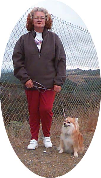
Dogs allowed. Ah, but we have that fence!
We CAN do better!!
Back to Jack Hickey's HomePage